Loading local storm outlook…
-- / 100
--Pressure / 50
--Humidity / 20
--Temperature / 10
--Camera light / 10
--Convergence / 10
Official National Weather Service status
Loading official alert status…
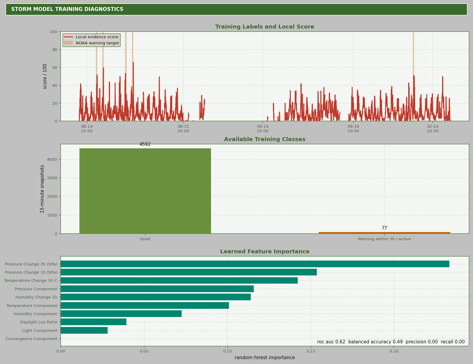
Learned three-hour NOAA-warning signal
Loading model status…
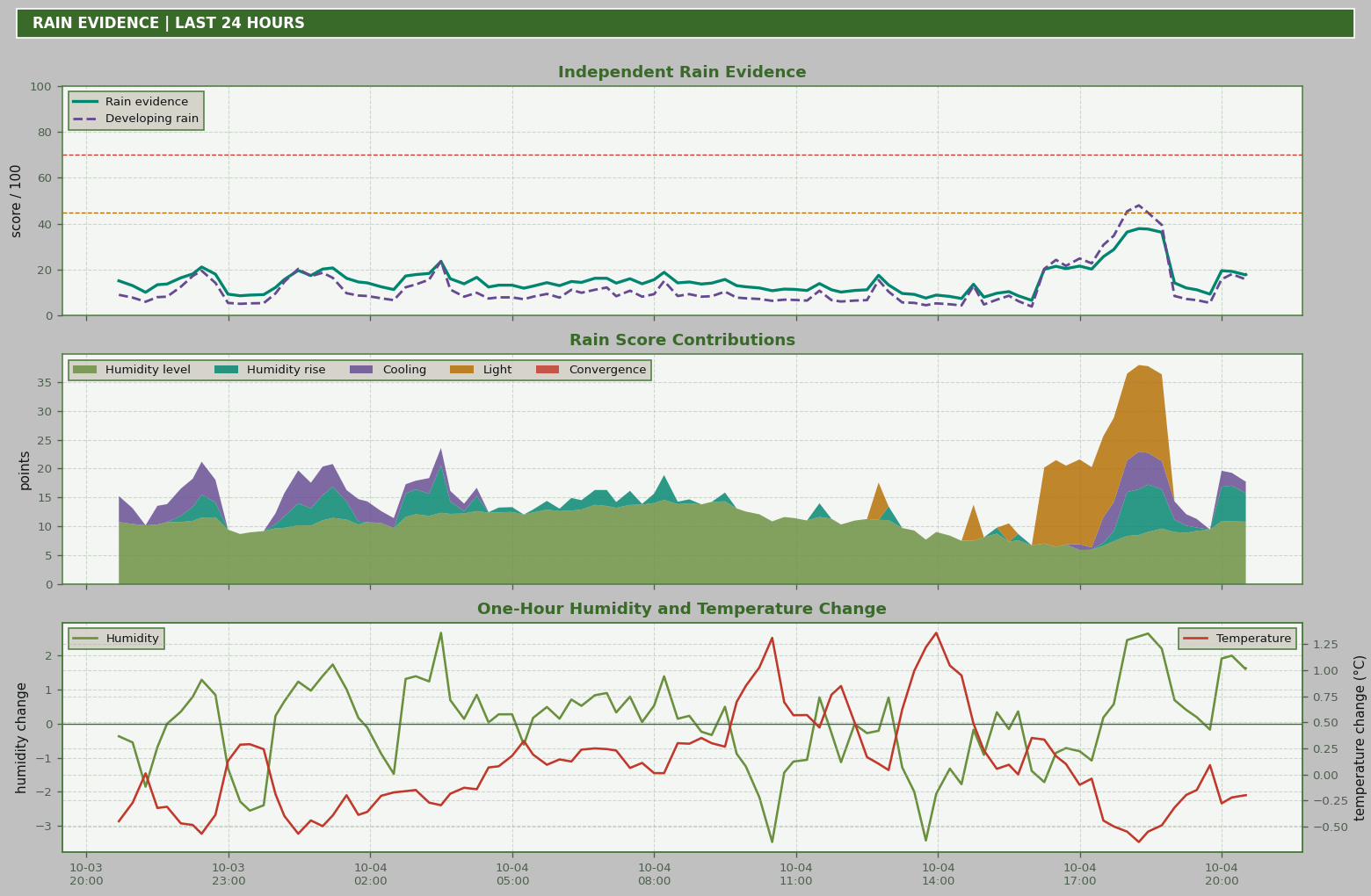
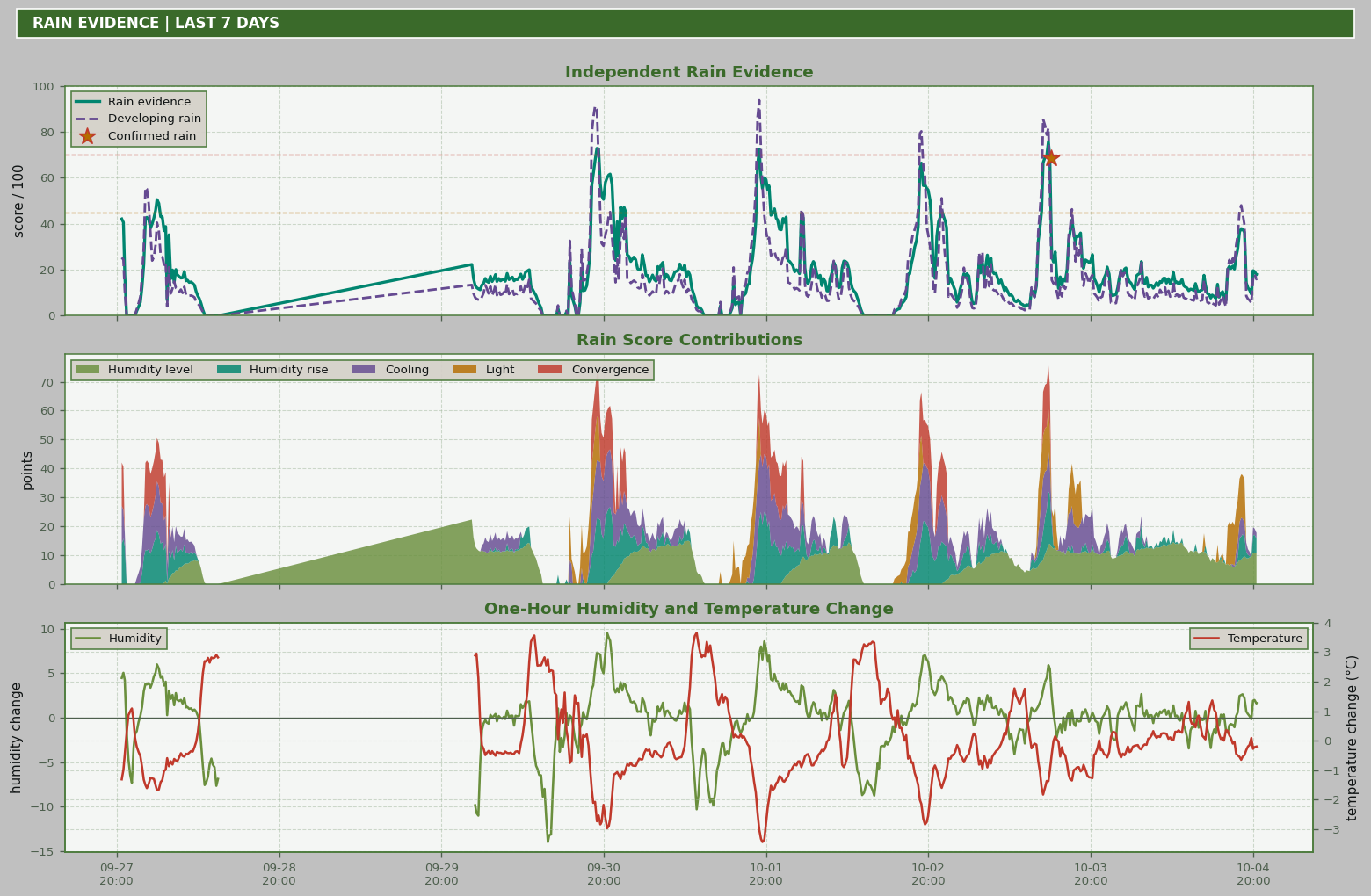
Loading local rain evidence…
-- / 100
Important: the local score is experimental and is not a substitute for official National Weather Service instructions. A single ground station cannot see an approaching storm, and some storms produce little advance pressure signal.
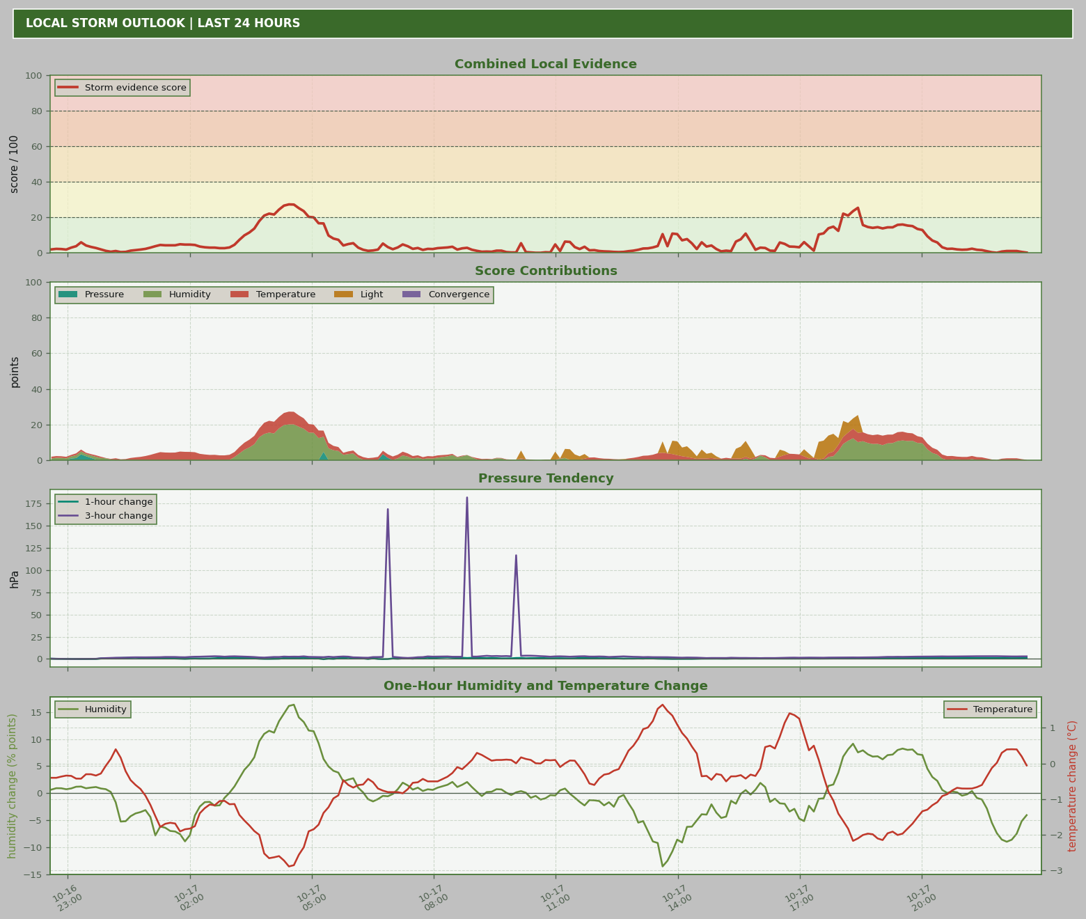
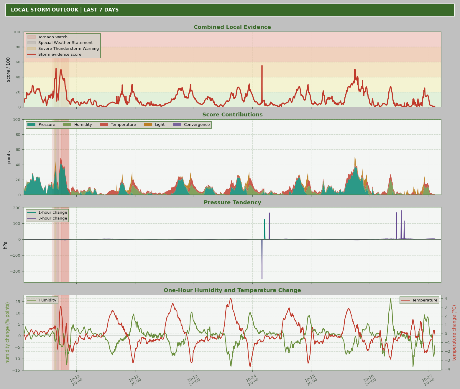
The score summarizes recent changes measured at this station. It is an explainable evidence score, not a neural-network probability. Falling pressure contributes most; rising humidity, rapid temperature change and an unusual daytime light drop add supporting evidence. Agreement between pressure and humidity earns an additional convergence component.
| Score | Display | Meaning |
|---|
| 0–19 | No strong local signal | Recent station measurements do not show a strong combination of storm indicators. |
| 20–39 | Atmospheric change | At least one measured channel is changing enough to watch. |
| 40–59 | Elevated indicators | Several changes or a substantial pressure tendency are present. |
| 60–79 | Possible storm approach | The local measurements show a strong, converging pattern. |
| 80–100 | Rapid deterioration | Multiple station indicators are changing unusually quickly. |
| Component | Maximum | Evidence used |
|---|
| Pressure | 50 | Pressure falls over one and three hours. |
| Humidity | 20 | Relative-humidity rise over one hour. |
| Temperature | 10 | Absolute temperature shift over one hour. |
| Camera light | 10 | Rapid daylight-only light reduction over 30 minutes. |
| Convergence | 10 | Pressure falling while humidity rises. |